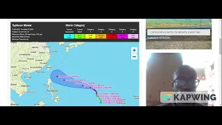
Update from Zachary Veal: “Tracking a Little Bit of Everything along with a Winter Weather Advisory North!”

THIS EVENING: A transition from mostly sunny skies this afternoon to mostly clear skies later on this evening around Metro Detroit on this Sunday evening along with both temperatures falling from the low-to-middle 40s early on into the middle-to-upper 30s later on and winds lightening up a bit WNW at only 5-12 mph.
TONIGHT: A transition from mostly clear skies early on to mostly cloudy skies later on along with both overnight low temperatures falling down into the low 30s and light winds E at only 5-10 mph.
TOMORROW: A mostly cloudy and chilly start to your Monday around Metro Detroit as we both get up and get going for either work, for the parents, or for school, for the kids, to morning low temperatures starting out in the low 30s. There is the potential threat for some freezing rain, especially in our North Zone both north of M-59 and along the I-69 corridor which made the National Weather Service issue a “Winter Weather Advisory” for Genesee, Lapeer, Livingston, Macomb, Oakland, Sanilac, and St. Clair Counties starting at 10am EST and expiring at 4am EST. So, travel at your own risk in those counties. But otherwise, tomorrow afternoon will be under mainly mostly cloudy skies with some rain possible, in spots especially south of I-94 where surface/ground/road temperatures are warmer, along with both daytime high temperatures only reaching the low 40s and winds ESE at 15-20 mph, gusting 30-40 mph, at times too!
TUESDAY: Partly cloudy skies, mild, and windy again too around Metro Detroit along with both daytime high temperatures rising into the upper 40s and gusty winds W at 15-25 mph, gusting 30-40 mph, at times too!
WEDNESDAY: Happy March 1st, everyone!! Mainly partly cloudy skies with perhaps some scattered showers, in spots, around Metro Detroit as we kick off the 3rd month of 2023 along with both daytime high temperatures soaring into the middle-to-upper 50s and much lighter winds thankfully.
THURSDAY: Partly cloudy skies around Metro Detroit along with daytime high temperatures falling down into the low 40s. So, it will be a bit cooler than Wednesday on your Thursday, for sure.
FRIDAY: Very windy with a potential winter storm that could bring measurable snow of maybe 7-14 inches to Metro Detroit along with both daytime high temperatures either a degree north or south of the freezing mark and gusty winds NNE at 15-20 mph, gusting 30-35 mph, at times too!
NEXT WEEKEND: Mainly partly cloudy skies with the possibility of some light snow showers, in spots, around Metro Detroit on your Saturday along with a daytime high temperature of only 40F. But on your Sunday as both you and your family commute both to and from both morning church services and brunch, we will be under mostly sunny skies along with a daytime high temperature of only 40F once again too.
Enjoy the rest of your Sunday, Metro Detroit!!
Donate to The Dakota Planet
$195
$1000
Contributed
Our Goal
Your donation will support the student journalists of Dakota High School. Your contribution will allow us to purchase equipment and cover our annual website hosting costs.
About the Writer
Zachary Veal, Writer/Teenager Meteorologist
Zachary Veal is a senior at Dakota High School. He is interested in music while playing percussion in his 3rd hour Concert Band class right here at Dakota,...