Here is tomorrow Afternoon’s (Wednesday May 24th, 2022’s) Severe Weather Risk!!
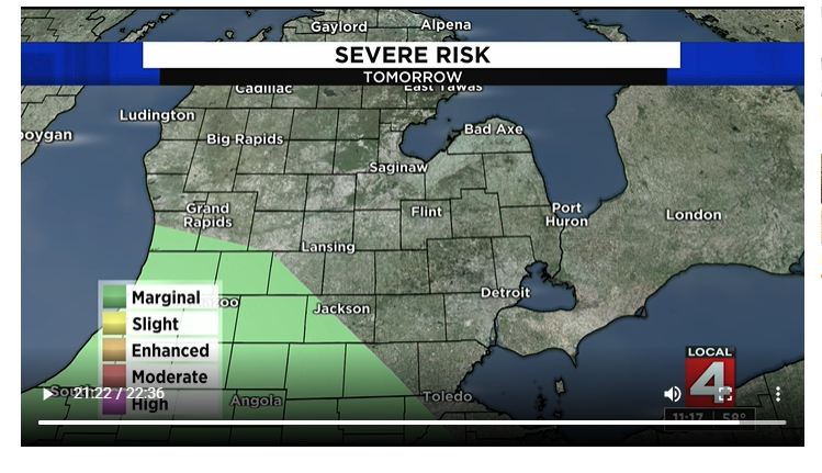
There is a Marginal Risk (Level 1 out of 5) for southwestern Lower Michigan (southwest of Jackson, entire of Kalamazoo, south-southwest of Grand Rapids, and all of Angola, Illinois) tomorrow afternoon on your “Hump Day”, or Wednesday! So, here are the greatest impacts weather-wise with this Marginal Risk:
- Gusty winds up to 60 mph.
- Pea-sized hail up to 1-inch in diameter.
- Localized flooding possible, due to heavy downpours.
- Frequent lightning.
Least impacts weather-wise with this Marginal Risk:
- Isolated tornado, even though it cannot be ruled out.
Donate to The Dakota Planet
$195
$1000
Contributed
Our Goal
Your donation will support the student journalists of Dakota High School. Your contribution will allow us to purchase equipment and cover our annual website hosting costs.
About the Contributor

Zachary Veal, Writer/Teenager Meteorologist
Zachary Veal is a senior at Dakota High School. He is interested in music while playing percussion in his 3rd hour Concert Band class right here at Dakota,...